
Experts recap January and provide outlooks through May
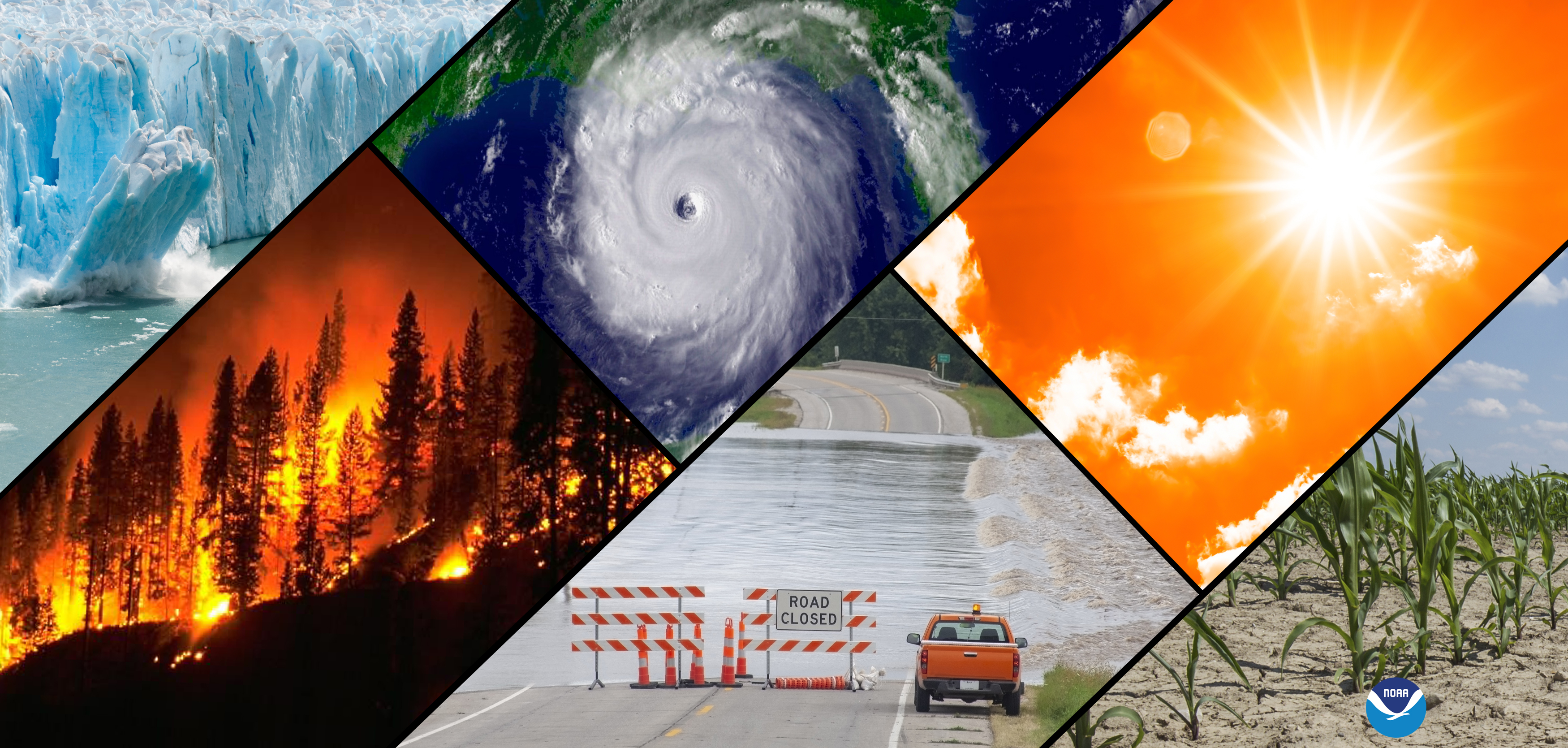
A collage of typical climate and weather-related events: floods, heatwaves, drought, hurricanes, wildfires and loss of glacial ice. (Image credit: NOAA)
RESOURCES
Transcript
Text Transcript
TRANSCRIPT
NOAA Monthly U.S./Global Analysis Media Briefing
February 20, 2025, at 11:00 am EDT via Adobe Connect
Hosted by NOAA NESDIS Public Affairs
Media advisory about briefing:
https://www.noaa.gov/media-advisory/noaa-monthly-us-global-climate-report-call-february-20
John Bateman: Good morning and thank you for joining this monthly media briefing part of
the suite of services that NOAA provides to government, business, academia, the media and the
public to support informed decision-making. I'm John Bateman and I will be facilitating today's
briefing. Today's update will have two short presentations from NOAA CEI and N work AA
CDC. NOAA experts will be available for questions which can be asked in the Q&A box
located at the bottom of your screen. Also the slides from the presentation will be available for
download. Click the link in the download window also at the bottom of the screen.
With that I will introduce our speakers. The first presenter is Russ Vose, the chief monitoring
and assessment branch at NCEI who will provide a summary of the January 2025 U.S. and
global temperature and precipitation analysis as well as the latest drought monitor update.
Our second presenter is Anthony Artusa, a meteorologist with NOAA's climate prediction center
or CPC. We will give the latest El Nino and La Nina updates as well as seasonal outlooks for
temperature, precipitation and drought for the next three months. We will kick off this media
briefing now with Russ from NOAA NCEI. Russ?
Russ Vose: Thanks, John and good morning, all. I'm going to start here this morning by talking
about the things at a global scale. January 2025, the map here shows you where -- what things
look like. If it is in red it is above normal temperatures and if it is blue, the areas were below
normal. The punch line is that the surface temperature was 2.41 degrees Fahrenheit above the
20th century average. So that was quite a bit above normal. I think the last -- the five warmest
years on record for January all happened in the past decade. This was among them.
The warmth of the global scale is notable because it happened during a La Nina. You can see
colder than normal temperatures in the eastern tropical Pacific ocean and along the coast of
South America. That tends to tug down global temperatures. It is a bit unusual we saw such a
warm January when that was going on. The features geographically I would point out otherwise
it was much above average in the Arctic and Alaska and Canada and central Eurasiaa. 4 to 5
degrees above average. It was below average in the lower 48 states and far eastern Russia and
Greenland.
One statistic, we track not just surface temperature and this map depicts service departure
temperatures, but temperatures in upper atmosphere and the midtropisphere was above the
1981 to 2010 average. That was the third warmest on record.
We are moving on to significant anomalies and events. This map highlights key things to
consider and I won't draw your attention to all of these, but I will point out a few, one of which is
global precipitation. Last month global precipitation was near average on a globe as a whole.
That's worth pointing out because that is not always the case. In January of 2023 it was the
second lowest global precipitation on record. This last month was relatively normal. There were
five tropical cyclones, two below the long-term average, and three were in the Indian Ocean
including one that did considerable damage to Mozambique and Madagascar.
It was the second lowest Eurasian snow cover since the 60s. And Arctic sea ice was below
average. It was second lowest on record for the Arctic. Then again that's for January
And now moving to the U.S. We have two maps here, the map on the left is temperature. The
map on the right is for precipitation. We will start with temperature on the left. The areas in
blue were below normal for the month of January. Anything red was above normal. The
obvious message is there is a lot more blue and grayish than you do red. Consistent with that is
worth pointing out that January of 2025 was actually the coldest January since 1988 in the lower
48 states. Much of the southeastern part of the country and the mid-Atlantic or parts of the upper
north were below average and places like New Mexico and Colorado and so on, above normal
areas were confined to the west coast and upper great plains and part of the great state of Maine.
It was a cold January in the lower 48.
The map on the right shows precipitation. This is a percent of average. If you see something in
brown it was drier than normal. If it is green it is wetter than normal. The punch line here is
most of the lower 48 was below normal or well below normal. I think the area average for the
lower 48 was 1.39 inches, almost an inch below average. I think this was the 6th driest January
on record. In fact, the only areas above normal were parts of Montana, Wyoming, eastern
Colorado, Kansas and some parts of eastern Texas and Arkansas and Florida. Not much. Much
of the rest of the country was pretty well below average or near average, particularly the
southwest.
Pointing out a few significant events and anomalies, we'll star
t with Alaska which doesn't get a lot of press, but it was a record season for Alaska and record
high temperatures. The southeast had some severe -- some snow and cold weather because it
was Antarctic air mass that showed up there toward middle or late of the month. It showed up
January 19th and a wide swath of the country got anywhere between 6 and 12 inches of snow,
particularly coastal regions of Texas, Louisiana, Mississippi, Alabama and Florida panhandle.
Then of course the other big story was January was the wildfires in Southern California
including the Palisades and the Eaton fire that's consumed 49,000 acres and destroyed over
16,000 structures. It was driven of course by the dry conditions and the high wind speeds
associated with Santa Ana winds.
And last, but not least, the current picture of the drought. This is a map as of February 18th, two
days ago. It is the most current map we vvment if you see anything in color, yellows and reds
and browns, those areas are currently experiencing drought. Overall, 57% of the nation is
abnormally dry or in drought. 67% of the lower 48. 15% of the nation is in severe drought or
worse and approximately 126.5 million people currently live in an area experiencing a drought.
All of the statistics are slight increases from this time last month. The droughts are particularly
focused in the southwestern United States, basically all of Arizona and Utah, for example, are
drier than normal. Much of Southern California, southern Utah, western New Mexico, southern
and western Texas and the upper plains such as Wyoming, South Dakota, Nebraska, Minnesota,
Iowa and so on. Along with parts of the Atlantic coast are drier. So a lot of drought, a bit more
than half the nation. We'll continue to track that.
I will hand the mic off to Anthony.
Anthony Artusa: All right. Thank you very much, Russ.
I'll continue on then with a look at the sea surface temperatures and what is called ENSO or the
El Nino southern oscillation. We are now on slide 7. Here we are looking at a picture of the
Pacific, or a map of the Pacific. Notice on the Eastside just for your bearings we have Central
America and South America and then lower left is Australia. So just to get your bearings a bit.
Where there is blue shading is representative of colder than normal sea surface temperatures and
where you have the orange shading, that's where we have warmer than normal sea surface
temperatures. This is a La Nina that is going on right now and the pattern we see here does
feature the below normal sea surface temperatures across the central and the east central Pacific.
Moving on to the outlooks. The first for March we have the monthly temperature outlook on the
left hand side and the monthly precipitation on the right hand side. Normally when we make
these types of forecasts including the seasonal which is to come, we tend to use a number of
climate models which are both dynamical and statistical in nature. We also look at composites
of past El Nino or La Nina events and a number of other tools. So in this case you can see that
for the temperatures on the left, we are going with below normal temperatures being favored
across the northwest and we also have above normal temperatures being favored across much of
the southern tier and across the gulf coast states. For Alaska, the below normal temperatures are
favored over the southeast and south central portions of the state, and we have some above
normal temperatures favored over much of northern Alaska. Moving on to the precipitation on
the right hand side, in this case we have above normal precipitation expected across the
northwest, the northern Rockies and perhaps even into northern parts of California. We also
have a large swath of above from The Great Lakes southward down approaching the lower
Mississippi valley, and a broad area of below normal precipitation chances across the southwest
and south central states. Notice for Alaska, although the tilt toward above normal are fairly
weak, there is that tendency for above in the northern say two-thirds of the mainland and then we
have equal chances across the southern third of the state and the equal chances mean the chances
for above, near and below normal are equal or very close to being equal and therefore we don't
have enough information in our guidance to tilt the forecast toward either above, near or below.
So I will move on to the next slide. We should be on number 9 and this is the seasonal forecast
for March, April and May. You will see a lot of similarity with the monthly forecast primarily
because of our ongoing La Nina which is expected to have an impact at least for the first half or
so of the season. We are going with below normal temperatures again on the left happened side
favored across the northwest and above normal across much of the south and eastern portions of
the lower 48 states. Historical trends are also fairly strong at this time of the year for the warmth
in the east, but they do get stronger as we move into the summer. For Alaska we have below
normal again across the southeast part of the state and above over the northern and western part
of Alaska.
Moving on to the precipitation, above normal precipitation is shown there in green across the
northwest once again and also from The Great Lakes from the lower Mississippi valley. And
these are very consistent with La Nina composites or what often is observed during La Nina
winters. Also below normal precipitation across a large chunk of the southwest, the central and
southern plains and even a weak tilt toward below for Florida.
In Alaska we have weak tilt to below along the southern coastline and a weak tilt toward above
in the northwest part of the state. So I will go on to slide 10, the drought outlook. This was just
issued this morning and it is valid through the end of May. Where you can see the brown
shading, the legend and key on the lower right indicates that the drought is expected to persist. I
should mention that this is based heavily on the U.S. drought monitor that Russ was showing
earlier. Let's say the yellow shading represents where drought development is likely. And then
we have the tan shading which is where drought remains, but improves. As an example it would
be say like D3 to D2 that would represent an improvement in the drought. And then the olive-
covered or olive-shaded green represents drought removal is likely.
So you can see that for most of the -- or I should say for much of the lower 48 where there is
currently drought it looks like a lot of it is expected to persist. We do expect some areas of
drought development that are likely in the areas of yellow. And then for areas we expect some
improvement or removal those are places like the Pacific northwest, The Great Lakes area and
parts of the Tennessee valley and also up in new England.
For Alaska we have some drought development possible there along the southern coast. And this
is in regards mostly to unusually low snow pack in the higher elevations.
Okay. That is what I had and I will turn it back over to John.
John Bateman: All right, thanks so much, Russ and Anthony. We will now open the briefing to
questions from the media. As a reminder, to ask a question, please find the Q&A box located at
the bottom of your screen. Please type in your name, affiliation, your question and the specific
expert you would like to answer it.
We have one in here right now. We don't have a name or affiliation with it, but Russ it looks like
it is for you and it could be a good one.
Why was the U.S. so much cooler than the rest of the world in January?
Russ: Thanks, John.
There are a couple of factors, but the primary driver was there was a ridge, a high pressure over
the Pacific and west coast and another blocking feature over Greenland. What that did was
helped cold air to spill in from the Arctic and just settle in over the U.S. over a good bit of the
month. So we had a cold January.
John: All right. Thank you.
The next one is from James Dinneen from the new scientist. You mentioned the notably warm
global average temperatures despite the La Nina episode. What is driving those temperatures?
Russ: I will take this, Anthony. Feel free to chime in.
James, we don't tend to put out an explanation for why a specific month was warmer or colder
than normal at the global scale. It is hard to do unless something dramatic happened, like, I don't
know, a volcanic eruption or something like that. We can't comment longer term and the warmth
that we saw say last year for example is probably tied to -- and in more recent years probably
been tied to things like reductions in air pollution over the ocean, particularly the north Atlantic
and north Pacific. Shipping regulations in 2020 reduced sulfur dioxide which reduces lower
cloud formation. With fewer emissions there are fewer clouds and more sunlight reaching the
ocean and warming it.
Along the same lines there is a lot of decrease in cloud cover and a study by NASA found a
tangible drop in global cloud cover in the past two decades in the tropics and midlatitudes. It is
one of those longer term things that my account why the recent years have been a little warmer.
I don't have a specific explanation for why January 2025 was particularly warm. I suspect those
factors contributed.
John: Great. Thank you so much, Russ.
The next question, Davis Nolan from WKRN in Nashville. This might be for Anthony.
With La Nina to neutral forecasts and above normal precipitations for our part of the country for
March, April and may, can you comment on if this will have an impact on the spring severe
weather season for the midsouth of the U.S.? It looks like he is looking around the Nashville,
Kentucky, Tennessee area. Is that an indicator for their severe weather season?
Anothony: Hi. This is Anthony.
This is a challenging question for sure. Normally what we would look at when we consider
severe weather during the springtime in the midsouth is the amount of wind shear that is
normally available. And also I know there have been specific studies that have been done. I just
can't point to one offhand, but I think it's -- I'm not really sure how to -- if we could say really
that much except in very general terms on the severe weather season. There are a lot of different
factors involved. There's a lot of variability within the season, and the only thing that comes to
mind right off the bat is the amount of wind shear, but I'm afraid I really couldn't answer beyond
that.
John: Okay. Thank you, Anthony.
Next question from Brian Sullivan from Bloomberg. He said, hi, I missed the last point about
the snowpack being below normal. Could you repeat that, and where was that and what caused
it?
Russ: Hi. This is Russ again, Brian.
I think I spoke about the fact and I think Anthony did. When I was talking about I was talking
about the snowpack over Eurasia it was the lowest, the second lowest for the month of January. I
hope that answers your question.
John: Thank you. And I'm not sure who would be best for this, but Craig Miller asked about the
polar vortexes -- or vortices this winter versus the typical two to three we might see. Is it the fact
we have seen upwards to 10 be an artifact of La Nina or something else?
Russ: This is Russ, Craig. I'm not sure I can like shed much light on this. I think there's been
some work to suggest going forward there may be more wobbliness in the polar vortex that may
lead to more outbreaks of cold -- you know, cold, Arctic air as we go forward in time. There is a
lot of variability associated with that. I'm not sure it is a really strong signal.
John: Okay. Thank you so much, Russ. I'm not seeing anymore on topic questions from the
media. Just as a reminder, type them into the Q&A box at the bottom of your screen. I believe
I'm not seeing anymore. With that we can put up our last slide for more information. Thank
you.
And I will wrap up this briefing. First I would like to thank everyone for their time and for
everyone in participating with the briefing. I will remind you to mark your calendar for a few
upcoming events. I will read them slowly so you can mark them down. The release of the
February 2025 U.S. temperature and precipitation analysis is scheduled for March 10th at 11
a.m. eastern time. The release for the February 2025 global temperature analysis is scheduled for
March 12th at 11 a.m. eastern time and we have something coming up in March in lieu of our
monthly briefing in March, NOAA will host the 2025 U.S. spring outlook media briefing at 11
a.m. eastern time on March 20th. Coincidentally, the first day of astronomical string. It will be
posted online.
Thank you for joining this briefing and have a good day.
On Thursday, climate and weather experts will discuss key findings from NOAA's U.S. and global climate analyses for January 2025, the latest El Nino/La Nina update, and the U.S. seasonal outlooks for temperature, precipitation and drought for the next three months.
WHEN
Thursday, February 20, 11:00 - 11:45 a.m. ET (USA)
WHO
- Russell Vose, Ph.D., Chief, Monitoring and Assessment Branch, NOAA National Centers for Environmental Information
- Anthony Artusa, Meteorologist, NOAA Climate Prediction Center
WHAT
- Webinar
- Presentations
- Questions and Answers
HOW
Use this link offsite link to register for the media briefing. (For the best experience, download the Adobe Connect app offsite link.)
Following the briefing, a recording will be posted to NOAA Satellites' YouTube Channel
FOR MORE INFORMATION:
NOAA National Centers for Environmental Information climate reports recapping January 2025: https://www.ncei.noaa.gov/access/monitoring/monthly-report/national/202501 (U.S.)
https://www.ncei.noaa.gov/access/monitoring/monthly-report/global/202501 (Global)
NOAA Climate Prediction Center outlooks & assessments: https://www.cpc.ncep.noaa.gov
NOAA El Niño/La Niña page: https://www.climate.gov/enso
NOAA Climate Portal: https://www.climate.gov
Upcoming NOAA climate monitoring reports: https://www.ncei.noaa.gov/access/monitoring/dyk/monthly-releases
Climate, weather and water affect all life on our ocean planet. NOAA’s mission is to understand and predict our changing environment, from the deep sea to outer space, and to manage and conserve America’s coastal and marine resources.
Media contact
nesdis.pa@noaa.gov, 202-424-0929
Related Features //
")
")
RESOURCES
Transcript
Text Transcript
TRANSCRIPT
NOAA Monthly U.S./Global Analysis Media Briefing
February 20, 2025, at 11:00 am EDT via Adobe Connect
Hosted by NOAA NESDIS Public Affairs
Media advisory about briefing:
https://www.noaa.gov/media-advisory/noaa-monthly-us-global-climate-report-call-february-20
John Bateman: Good morning and thank you for joining this monthly media briefing part of
the suite of services that NOAA provides to government, business, academia, the media and the
public to support informed decision-making. I'm John Bateman and I will be facilitating today's
briefing. Today's update will have two short presentations from NOAA CEI and N work AA
CDC. NOAA experts will be available for questions which can be asked in the Q&A box
located at the bottom of your screen. Also the slides from the presentation will be available for
download. Click the link in the download window also at the bottom of the screen.
With that I will introduce our speakers. The first presenter is Russ Vose, the chief monitoring
and assessment branch at NCEI who will provide a summary of the January 2025 U.S. and
global temperature and precipitation analysis as well as the latest drought monitor update.
Our second presenter is Anthony Artusa, a meteorologist with NOAA's climate prediction center
or CPC. We will give the latest El Nino and La Nina updates as well as seasonal outlooks for
temperature, precipitation and drought for the next three months. We will kick off this media
briefing now with Russ from NOAA NCEI. Russ?
Russ Vose: Thanks, John and good morning, all. I'm going to start here this morning by talking
about the things at a global scale. January 2025, the map here shows you where -- what things
look like. If it is in red it is above normal temperatures and if it is blue, the areas were below
normal. The punch line is that the surface temperature was 2.41 degrees Fahrenheit above the
20th century average. So that was quite a bit above normal. I think the last -- the five warmest
years on record for January all happened in the past decade. This was among them.
The warmth of the global scale is notable because it happened during a La Nina. You can see
colder than normal temperatures in the eastern tropical Pacific ocean and along the coast of
South America. That tends to tug down global temperatures. It is a bit unusual we saw such a
warm January when that was going on. The features geographically I would point out otherwise
it was much above average in the Arctic and Alaska and Canada and central Eurasiaa. 4 to 5
degrees above average. It was below average in the lower 48 states and far eastern Russia and
Greenland.
One statistic, we track not just surface temperature and this map depicts service departure
temperatures, but temperatures in upper atmosphere and the midtropisphere was above the
1981 to 2010 average. That was the third warmest on record.
We are moving on to significant anomalies and events. This map highlights key things to
consider and I won't draw your attention to all of these, but I will point out a few, one of which is
global precipitation. Last month global precipitation was near average on a globe as a whole.
That's worth pointing out because that is not always the case. In January of 2023 it was the
second lowest global precipitation on record. This last month was relatively normal. There were
five tropical cyclones, two below the long-term average, and three were in the Indian Ocean
including one that did considerable damage to Mozambique and Madagascar.
It was the second lowest Eurasian snow cover since the 60s. And Arctic sea ice was below
average. It was second lowest on record for the Arctic. Then again that's for January
And now moving to the U.S. We have two maps here, the map on the left is temperature. The
map on the right is for precipitation. We will start with temperature on the left. The areas in
blue were below normal for the month of January. Anything red was above normal. The
obvious message is there is a lot more blue and grayish than you do red. Consistent with that is
worth pointing out that January of 2025 was actually the coldest January since 1988 in the lower
48 states. Much of the southeastern part of the country and the mid-Atlantic or parts of the upper
north were below average and places like New Mexico and Colorado and so on, above normal
areas were confined to the west coast and upper great plains and part of the great state of Maine.
It was a cold January in the lower 48.
The map on the right shows precipitation. This is a percent of average. If you see something in
brown it was drier than normal. If it is green it is wetter than normal. The punch line here is
most of the lower 48 was below normal or well below normal. I think the area average for the
lower 48 was 1.39 inches, almost an inch below average. I think this was the 6th driest January
on record. In fact, the only areas above normal were parts of Montana, Wyoming, eastern
Colorado, Kansas and some parts of eastern Texas and Arkansas and Florida. Not much. Much
of the rest of the country was pretty well below average or near average, particularly the
southwest.
Pointing out a few significant events and anomalies, we'll star
t with Alaska which doesn't get a lot of press, but it was a record season for Alaska and record
high temperatures. The southeast had some severe -- some snow and cold weather because it
was Antarctic air mass that showed up there toward middle or late of the month. It showed up
January 19th and a wide swath of the country got anywhere between 6 and 12 inches of snow,
particularly coastal regions of Texas, Louisiana, Mississippi, Alabama and Florida panhandle.
Then of course the other big story was January was the wildfires in Southern California
including the Palisades and the Eaton fire that's consumed 49,000 acres and destroyed over
16,000 structures. It was driven of course by the dry conditions and the high wind speeds
associated with Santa Ana winds.
And last, but not least, the current picture of the drought. This is a map as of February 18th, two
days ago. It is the most current map we vvment if you see anything in color, yellows and reds
and browns, those areas are currently experiencing drought. Overall, 57% of the nation is
abnormally dry or in drought. 67% of the lower 48. 15% of the nation is in severe drought or
worse and approximately 126.5 million people currently live in an area experiencing a drought.
All of the statistics are slight increases from this time last month. The droughts are particularly
focused in the southwestern United States, basically all of Arizona and Utah, for example, are
drier than normal. Much of Southern California, southern Utah, western New Mexico, southern
and western Texas and the upper plains such as Wyoming, South Dakota, Nebraska, Minnesota,
Iowa and so on. Along with parts of the Atlantic coast are drier. So a lot of drought, a bit more
than half the nation. We'll continue to track that.
I will hand the mic off to Anthony.
Anthony Artusa: All right. Thank you very much, Russ.
I'll continue on then with a look at the sea surface temperatures and what is called ENSO or the
El Nino southern oscillation. We are now on slide 7. Here we are looking at a picture of the
Pacific, or a map of the Pacific. Notice on the Eastside just for your bearings we have Central
America and South America and then lower left is Australia. So just to get your bearings a bit.
Where there is blue shading is representative of colder than normal sea surface temperatures and
where you have the orange shading, that's where we have warmer than normal sea surface
temperatures. This is a La Nina that is going on right now and the pattern we see here does
feature the below normal sea surface temperatures across the central and the east central Pacific.
Moving on to the outlooks. The first for March we have the monthly temperature outlook on the
left hand side and the monthly precipitation on the right hand side. Normally when we make
these types of forecasts including the seasonal which is to come, we tend to use a number of
climate models which are both dynamical and statistical in nature. We also look at composites
of past El Nino or La Nina events and a number of other tools. So in this case you can see that
for the temperatures on the left, we are going with below normal temperatures being favored
across the northwest and we also have above normal temperatures being favored across much of
the southern tier and across the gulf coast states. For Alaska, the below normal temperatures are
favored over the southeast and south central portions of the state, and we have some above
normal temperatures favored over much of northern Alaska. Moving on to the precipitation on
the right hand side, in this case we have above normal precipitation expected across the
northwest, the northern Rockies and perhaps even into northern parts of California. We also
have a large swath of above from The Great Lakes southward down approaching the lower
Mississippi valley, and a broad area of below normal precipitation chances across the southwest
and south central states. Notice for Alaska, although the tilt toward above normal are fairly
weak, there is that tendency for above in the northern say two-thirds of the mainland and then we
have equal chances across the southern third of the state and the equal chances mean the chances
for above, near and below normal are equal or very close to being equal and therefore we don't
have enough information in our guidance to tilt the forecast toward either above, near or below.
So I will move on to the next slide. We should be on number 9 and this is the seasonal forecast
for March, April and May. You will see a lot of similarity with the monthly forecast primarily
because of our ongoing La Nina which is expected to have an impact at least for the first half or
so of the season. We are going with below normal temperatures again on the left happened side
favored across the northwest and above normal across much of the south and eastern portions of
the lower 48 states. Historical trends are also fairly strong at this time of the year for the warmth
in the east, but they do get stronger as we move into the summer. For Alaska we have below
normal again across the southeast part of the state and above over the northern and western part
of Alaska.
Moving on to the precipitation, above normal precipitation is shown there in green across the
northwest once again and also from The Great Lakes from the lower Mississippi valley. And
these are very consistent with La Nina composites or what often is observed during La Nina
winters. Also below normal precipitation across a large chunk of the southwest, the central and
southern plains and even a weak tilt toward below for Florida.
In Alaska we have weak tilt to below along the southern coastline and a weak tilt toward above
in the northwest part of the state. So I will go on to slide 10, the drought outlook. This was just
issued this morning and it is valid through the end of May. Where you can see the brown
shading, the legend and key on the lower right indicates that the drought is expected to persist. I
should mention that this is based heavily on the U.S. drought monitor that Russ was showing
earlier. Let's say the yellow shading represents where drought development is likely. And then
we have the tan shading which is where drought remains, but improves. As an example it would
be say like D3 to D2 that would represent an improvement in the drought. And then the olive-
covered or olive-shaded green represents drought removal is likely.
So you can see that for most of the -- or I should say for much of the lower 48 where there is
currently drought it looks like a lot of it is expected to persist. We do expect some areas of
drought development that are likely in the areas of yellow. And then for areas we expect some
improvement or removal those are places like the Pacific northwest, The Great Lakes area and
parts of the Tennessee valley and also up in new England.
For Alaska we have some drought development possible there along the southern coast. And this
is in regards mostly to unusually low snow pack in the higher elevations.
Okay. That is what I had and I will turn it back over to John.
John Bateman: All right, thanks so much, Russ and Anthony. We will now open the briefing to
questions from the media. As a reminder, to ask a question, please find the Q&A box located at
the bottom of your screen. Please type in your name, affiliation, your question and the specific
expert you would like to answer it.
We have one in here right now. We don't have a name or affiliation with it, but Russ it looks like
it is for you and it could be a good one.
Why was the U.S. so much cooler than the rest of the world in January?
Russ: Thanks, John.
There are a couple of factors, but the primary driver was there was a ridge, a high pressure over
the Pacific and west coast and another blocking feature over Greenland. What that did was
helped cold air to spill in from the Arctic and just settle in over the U.S. over a good bit of the
month. So we had a cold January.
John: All right. Thank you.
The next one is from James Dinneen from the new scientist. You mentioned the notably warm
global average temperatures despite the La Nina episode. What is driving those temperatures?
Russ: I will take this, Anthony. Feel free to chime in.
James, we don't tend to put out an explanation for why a specific month was warmer or colder
than normal at the global scale. It is hard to do unless something dramatic happened, like, I don't
know, a volcanic eruption or something like that. We can't comment longer term and the warmth
that we saw say last year for example is probably tied to -- and in more recent years probably
been tied to things like reductions in air pollution over the ocean, particularly the north Atlantic
and north Pacific. Shipping regulations in 2020 reduced sulfur dioxide which reduces lower
cloud formation. With fewer emissions there are fewer clouds and more sunlight reaching the
ocean and warming it.
Along the same lines there is a lot of decrease in cloud cover and a study by NASA found a
tangible drop in global cloud cover in the past two decades in the tropics and midlatitudes. It is
one of those longer term things that my account why the recent years have been a little warmer.
I don't have a specific explanation for why January 2025 was particularly warm. I suspect those
factors contributed.
John: Great. Thank you so much, Russ.
The next question, Davis Nolan from WKRN in Nashville. This might be for Anthony.
With La Nina to neutral forecasts and above normal precipitations for our part of the country for
March, April and may, can you comment on if this will have an impact on the spring severe
weather season for the midsouth of the U.S.? It looks like he is looking around the Nashville,
Kentucky, Tennessee area. Is that an indicator for their severe weather season?
Anothony: Hi. This is Anthony.
This is a challenging question for sure. Normally what we would look at when we consider
severe weather during the springtime in the midsouth is the amount of wind shear that is
normally available. And also I know there have been specific studies that have been done. I just
can't point to one offhand, but I think it's -- I'm not really sure how to -- if we could say really
that much except in very general terms on the severe weather season. There are a lot of different
factors involved. There's a lot of variability within the season, and the only thing that comes to
mind right off the bat is the amount of wind shear, but I'm afraid I really couldn't answer beyond
that.
John: Okay. Thank you, Anthony.
Next question from Brian Sullivan from Bloomberg. He said, hi, I missed the last point about
the snowpack being below normal. Could you repeat that, and where was that and what caused
it?
Russ: Hi. This is Russ again, Brian.
I think I spoke about the fact and I think Anthony did. When I was talking about I was talking
about the snowpack over Eurasia it was the lowest, the second lowest for the month of January. I
hope that answers your question.
John: Thank you. And I'm not sure who would be best for this, but Craig Miller asked about the
polar vortexes -- or vortices this winter versus the typical two to three we might see. Is it the fact
we have seen upwards to 10 be an artifact of La Nina or something else?
Russ: This is Russ, Craig. I'm not sure I can like shed much light on this. I think there's been
some work to suggest going forward there may be more wobbliness in the polar vortex that may
lead to more outbreaks of cold -- you know, cold, Arctic air as we go forward in time. There is a
lot of variability associated with that. I'm not sure it is a really strong signal.
John: Okay. Thank you so much, Russ. I'm not seeing anymore on topic questions from the
media. Just as a reminder, type them into the Q&A box at the bottom of your screen. I believe
I'm not seeing anymore. With that we can put up our last slide for more information. Thank
you.
And I will wrap up this briefing. First I would like to thank everyone for their time and for
everyone in participating with the briefing. I will remind you to mark your calendar for a few
upcoming events. I will read them slowly so you can mark them down. The release of the
February 2025 U.S. temperature and precipitation analysis is scheduled for March 10th at 11
a.m. eastern time. The release for the February 2025 global temperature analysis is scheduled for
March 12th at 11 a.m. eastern time and we have something coming up in March in lieu of our
monthly briefing in March, NOAA will host the 2025 U.S. spring outlook media briefing at 11
a.m. eastern time on March 20th. Coincidentally, the first day of astronomical string. It will be
posted online.
Thank you for joining this briefing and have a good day.