
Safer drinking water, improved forecasts are just some ways NOAA is working for you
July 31, 2024: Emergency personnel respond to the Park Fire in California. (Image credit: California Department of Forestry and Fire Protection)
NOAA researchers are working to reduce the impacts of hazardous weather, promote sustainable use and stewardship of ocean and coastal resources and ensure a robust research and development enterprise to support a strong economy.
NOAA is conducting research that matters. Here are five examples:
1. Improving wildfire forecasts with satellites and AI
")
The earlier the better: Firefighters, land managers, emergency managers and frontline communities need speedy access to accurate wildfire forecasts to reduce the spread of the fire, ultimately saving lives and property.
NOAA and partners are bringing together GOES-R geostationary satellite observations and artificial intelligence to improve detection and response time with the Next Generation Fire System (NGFS). NGFS combines satellite-based fire detection with independent data, such as NOAA’s National Weather Service (NWS) fire weather outlooks and red flag warnings, to provide critical information for regional and local decision making and analysis. NGFS is used to develop a nationwide hotspot notification and fire warning service tested in the NOAA Fire Testbed.
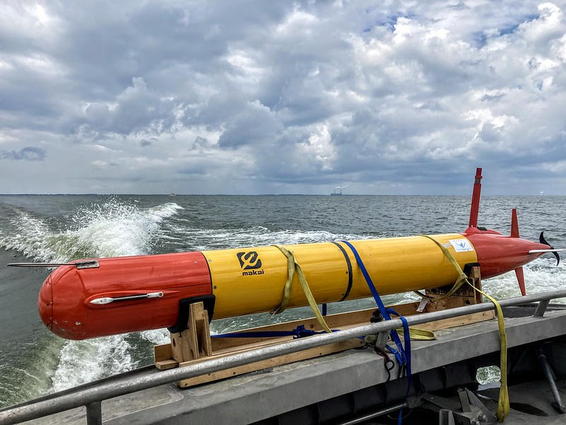
2. Ensuring safe drinking water with an underwater robot
A long-range autonomous underwater vehicle equipped with water sampling and analysis tools offsite linkwas launched in Lake Erie to detect toxins that are found in harmful algal blooms (HABS) that are harmful to humans, animals and ecosystems. The uncrewed system offsite link showed its ability to transmit the analysis of water samples back to shore in under two hours. Piloted from shore to areas of the lake near algal blooms, the system can measure the spatial extent and intensity of the bloom, enabling water managers to take quick action to protect drinking water supplies and warn the public of HABs.
3. Better flood maps, helping communities plan
")
NOAA is implementing new experimental flood inundation maps to help NWS issue timely and effective flood watches and warnings. The flood mapping information predicts the timing and the magnitude of flooding, allowing emergency managers to pre-position resources, secure critical infrastructure, recommend evacuations and evacuation routes and support recovery efforts. As of September 2024, over 30% of the U.S. population had access to this information through the National Water Prediction Service. Flood inundation maps will be expanded to cover much of the U.S. in fiscal years 2025 and 2026.
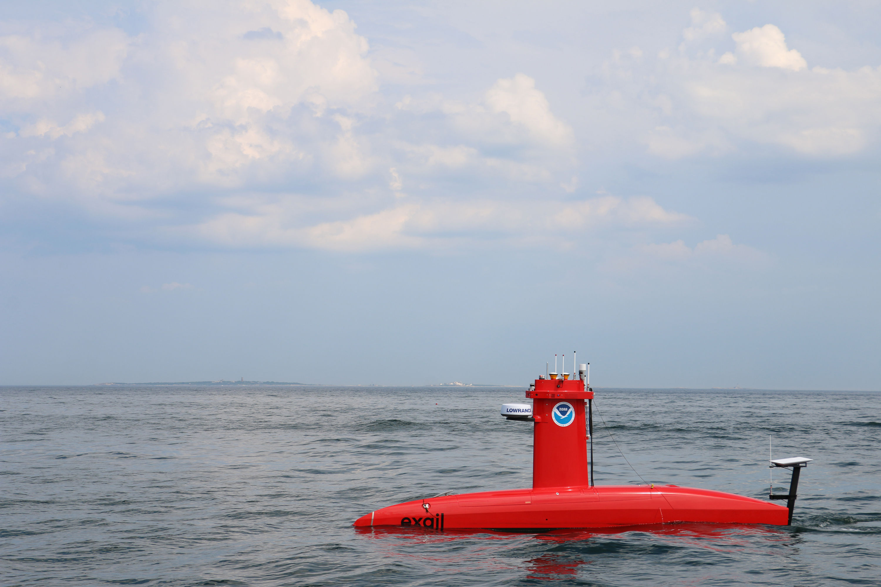
4. Mapping the seafloor with uncrewed systems
")
After transitioning the DriX uncrewed surface vehicle to operations in 2023 for hydrographic surveys, NOAA deployed the DriX in 2024 to join with NOAA Ship Thomas Jefferson to survey approaches to Savannah, Georgia — one of the most heavily-trafficked areas of the U.S. Atlantic Coast.
The DriX is able to nearly double the linear nautical miles surveyed by the ship’s crewed small boats. NOAA also tested the use of two DriX in the Gulf of Maine for a range of ocean observing missions, including seafloor mapping, assessing potential sites for offshore wind and characterizing the deep ocean.
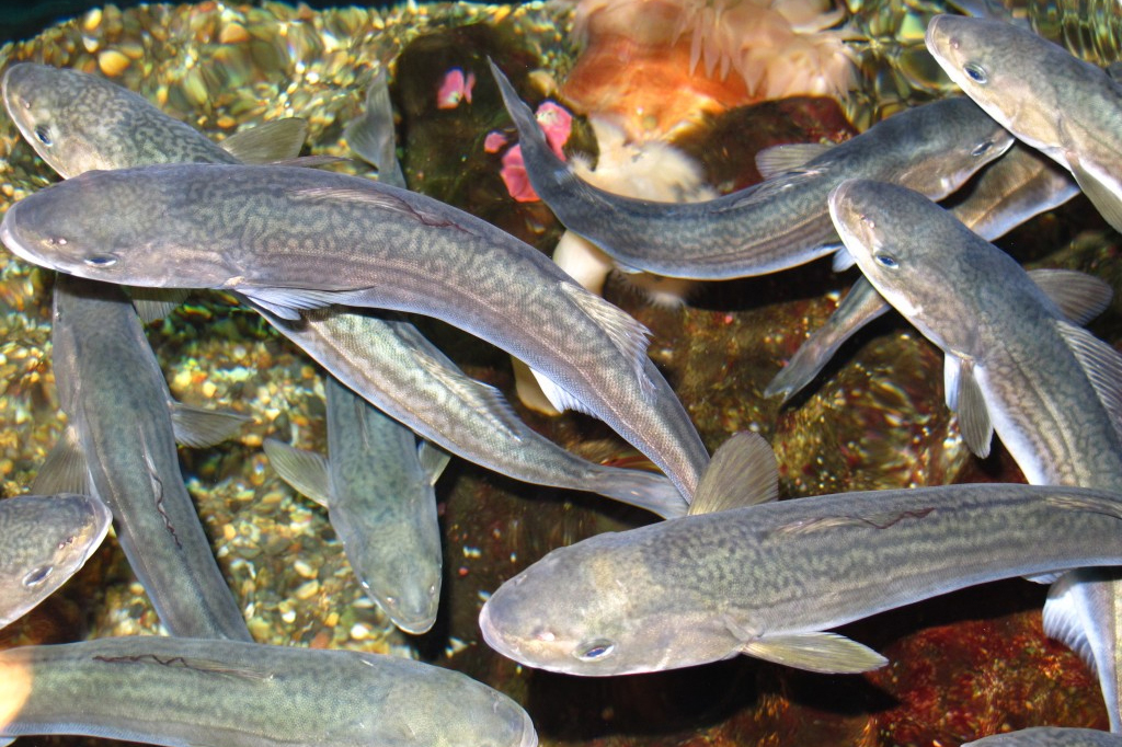
5. Sequencing fish genes for a healthy fishery
")
Understanding the genetic structure of fish populations is vital to managing them sustainably. NOAA and partners completed a new study that sequenced the genome of juvenile sablefish that confirms North Pacific sablefish migrate and mix throughout their northern range in the waters off Alaska and Washington state.
Earlier research suggested there might be distinct stocks which would have needed a different management approach to ensure healthy fisheries. The 2024 genetic study confirms the scientific wisdom of the current management.
For more information, contact monica.allen@noaa.gov, (202) 379-6693
")
")